
- This event has passed.
11th February : 1:00 pm – 2:30 pm
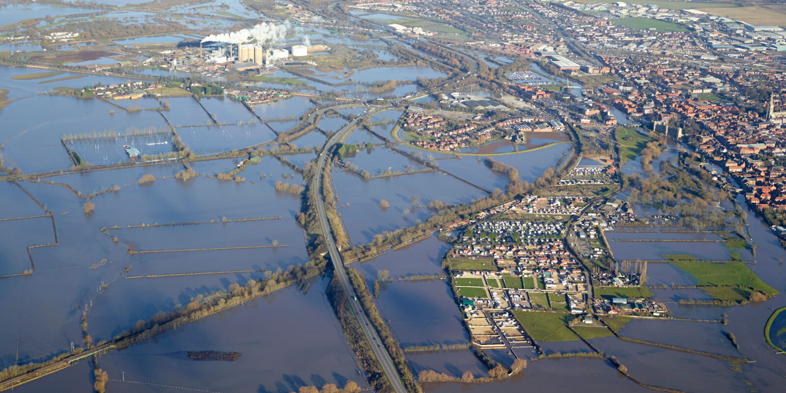
What does the new flood risk and coastal erosion mapping mean for development planning?
If you’re a local authority officer working for a local planning authority or lead local flood authority on either planning policy or development management, you are invited to join this webinar. The event will focus on the implications of the new flood risk and coastal erosion data on development planning, helping you to prepare for and to use the new data when it’s published in spring 2025.
You can register your questions ahead of the event. We will do our best to address your questions at the event.
If you have a question you would like the panel to address during the webinar please share using Slido. You can also upvote questions submitted by others to help us shape the agenda. Link: https://app.sli.do/event/9XKQiDaEtUCvC9jx3NmA7K
All webinar registration details will be held by the TCPA in line with our privacy policy. As a delivery partner, we may also share webinar participant information with the Environment Agency, who will use information for purposes directly linked to this webinar only.
Agenda
- Welcome and introductions
- Scene setting – EA’s role, role of flood and coastal risk data in planning, planning policy
- Introduction to our new datasets and how they’re being improved
- What new flood data we will publish, when and where it will be hosted
- Changes to the Flood Map for Planning
- What new coastal erosion risk data we have published and where it is hosted
- How is the new data changing our understanding of risk
- How will the new data affect key planning issues
- How we’re communicating changes and what support are we offering?
- An opportunity to ask questions
Do I need to prepare for the meeting?
There is no pre-reading. However, it may be helpful for you to take a look at the National assessment of flood and coastal erosion risk in England 2024 report, which we published in December. Whilst the report focuses primarily on the findings from data not aimed at development planning, it provides a helpful overview of how our understanding of risk has changed.
We also encourage you to watch this introductory video in advance of the event – Environment Agency updates to flood and coastal erosion risk information. (registration to the SharePoint site is required see details below)
You can read more here about our Updates to national flood and coastal erosion risk information. You can explore some of the new data we’ve already published here:
- Check your long term flood risk
- Check coastal erosion risk for an area in England
- Shoreline Management Plan Explorer
To view the introductory video, get further details and supporting materials available from our SharePoint site send an email to admin_fcermprojectsupport@environment-agency.gov.uk to request access.